Welcome to Rossendale: Welcome to Lancashire
Introduction
The photograph on this page of Welcome to Rossendale: Welcome to Lancashire by Steven Haslington as part of the Geograph project.
The Geograph project started in 2005 with the aim of publishing, organising and preserving representative images for every square kilometre of Great Britain, Ireland and the Isle of Man.

There are currently over 7.5m images from over 14,400 individuals and you can help contribute to the project by visiting https://www.geograph.org.uk
Welcome to Rossendale: Welcome to Lancashire
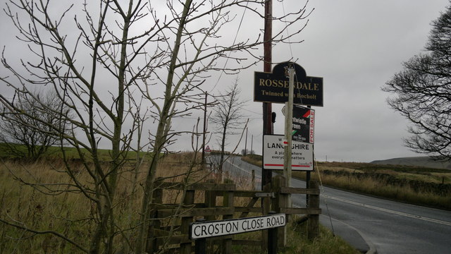
Image: © Steven Haslington Taken: 18 Nov 2011
High in the South Pennines, by Scout Moor Wind Farm, at the junction of Croston Close Road and Edenfield/Rochdale Road, is the boundary between the Borough of Rossendale and the Metropolitan Borough of Rochdale, which in turn is the post-1974 county boundary between Lancashire and Greater Manchester (respectively). The boundary is marked by various welcome signage, include those pictured here for Rossendale and Lancashire.
Images are licensed for reuse under creativecommons.org/licenses/by-sa/2.0
Image Location


Leaflet Map data © OpenStreetMap
Latitude
53.645243
Longitude
-2.269977