Deanston, Teith Road
Introduction
The photograph on this page of Deanston, Teith Road by Robert Murray as part of the Geograph project.
The Geograph project started in 2005 with the aim of publishing, organising and preserving representative images for every square kilometre of Great Britain, Ireland and the Isle of Man.

There are currently over 7.5m images from over 14,400 individuals and you can help contribute to the project by visiting https://www.geograph.org.uk
Deanston, Teith Road
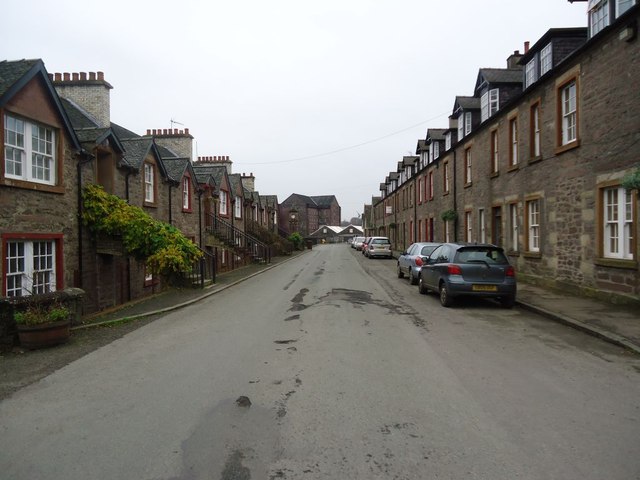
Image: © Robert Murray Taken: 15 Nov 2011
Mill workers housing built in the 19th. century. the row on the right is called (the) First Division and was built for managers. The building on the right is (the) Second Division and housed the next level down from the exalted across the road. Interesting that (the) First Division has a level lower than the road and sits on the same level as the lade/canal which passes by in an underground tunnel very near the back of the houses. See RCAHMS site report http://canmore.rcahms.gov.uk/en/site/305252/details/deanston+deanston+mills+culverted+lade+section/
Images are licensed for reuse under creativecommons.org/licenses/by-sa/2.0
Image Location
Latitude
56.190585
Longitude
-4.07403