Manor Farm
Introduction
The photograph on this page of Manor Farm by Alan Murray-Rust as part of the Geograph project.
The Geograph project started in 2005 with the aim of publishing, organising and preserving representative images for every square kilometre of Great Britain, Ireland and the Isle of Man.

There are currently over 7.5m images from over 14,400 individuals and you can help contribute to the project by visiting https://www.geograph.org.uk
Manor Farm
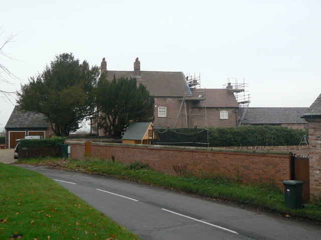
Image: © Alan Murray-Rust Taken: 11 Nov 2011
Farming activity has ceased here, with the ranges of farm buildings converted to or replaced by residential accommodation. The farm house itself dates from the early 17th century http://www.geograph.org.uk/photo/2696584, but the front seen here is mid 18th century, in typical local style. Listed Grade II.
Images are licensed for reuse under creativecommons.org/licenses/by-sa/2.0
Image Location
Latitude
52.892293
Longitude
-1.087482