Plumtree School
Introduction
The photograph on this page of Plumtree School by Alan Murray-Rust as part of the Geograph project.
The Geograph project started in 2005 with the aim of publishing, organising and preserving representative images for every square kilometre of Great Britain, Ireland and the Isle of Man.

There are currently over 7.5m images from over 14,400 individuals and you can help contribute to the project by visiting https://www.geograph.org.uk
Plumtree School
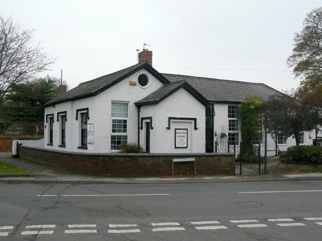
Image: © Alan Murray-Rust Taken: 11 Nov 2011
Built in 1840 http://www.geograph.org.uk/photo/2696102, it became a Church of England Controlled School in 1951 until closure in 1974. More recently it has become a privately run primary school.
Images are licensed for reuse under creativecommons.org/licenses/by-sa/2.0
Image Location
Latitude
52.890696
Longitude
-1.090191