Buildings around the Monument, viewed from Shad Thames
Introduction
The photograph on this page of Buildings around the Monument, viewed from Shad Thames by Robert Lamb as part of the Geograph project.
The Geograph project started in 2005 with the aim of publishing, organising and preserving representative images for every square kilometre of Great Britain, Ireland and the Isle of Man.

There are currently over 7.5m images from over 14,400 individuals and you can help contribute to the project by visiting https://www.geograph.org.uk
Buildings around the Monument, viewed from Shad Thames
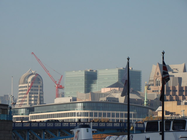
Image: © Robert Lamb Taken: 13 Nov 2011
The Monument has some rather unusual-looking buildings. The slender building on the right is on the corner of Great Tower Street and Mark Lane and is called Minster Court, the domed building in the centre is Sugar Quay, a block of flats on Lower Thames Street. In front of that is the former Port of London Authority building (now a restaurant, cocktail bar and multi-storey car park) and the building which looks rather like R2D2 is 20 Gracechurch Street, a shopping complex at the corner of Gracechurch and Lombard Streets. Looking northwest.
Images are licensed for reuse under creativecommons.org/licenses/by-sa/2.0
Image Location


Leaflet Map data © OpenStreetMap
Latitude
51.51057
Longitude
-0.084706