Coleraine Methodist church
Introduction
The photograph on this page of Coleraine Methodist church by Albert Bridge as part of the Geograph project.
The Geograph project started in 2005 with the aim of publishing, organising and preserving representative images for every square kilometre of Great Britain, Ireland and the Isle of Man.

There are currently over 7.5m images from over 14,400 individuals and you can help contribute to the project by visiting https://www.geograph.org.uk
Coleraine Methodist church
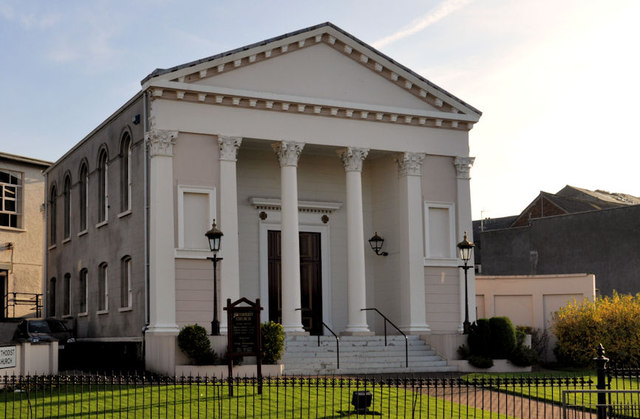
Image: © Albert Bridge Taken: 14 Nov 2011
Listed (HB03/18/021) church on the Circular Road, built in 1854 with financial assistance, inter alia, from the Honourable the Irish Society and the Worshipful Company of Clothworkers. It replaced one built in 1801 and has more than a passing resemblance to another Image built a few years earlier (1850).
Images are licensed for reuse under creativecommons.org/licenses/by-sa/2.0
Image Location
Latitude
55.132298
Longitude
-6.673141