Crane Park Island, Upstream End
Introduction
The photograph on this page of Crane Park Island, Upstream End by Des Blenkinsopp as part of the Geograph project.
The Geograph project started in 2005 with the aim of publishing, organising and preserving representative images for every square kilometre of Great Britain, Ireland and the Isle of Man.

There are currently over 7.5m images from over 14,400 individuals and you can help contribute to the project by visiting https://www.geograph.org.uk
Crane Park Island, Upstream End
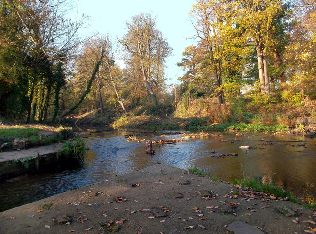
Image: © Des Blenkinsopp Taken: 13 Nov 2011
Crane Park Island is an area between the river Crane and a mill stream cut to power gunpowder mills which operated here until 1926. The main flow goes down the channel on the left in this picture. The right hand channel is the mill leat, which although it looks wider here is now silted up and overgrown and carries only a small flow. Remains of the powder mills can still be seen on the island. There are some foundations, water channels and mill wheel bays still visible in the undergrowth. The island is now a nature reserve run by the London Wildlife Trust.
Images are licensed for reuse under creativecommons.org/licenses/by-sa/2.0
Image Location
Latitude
51.444341
Longitude
-0.380031