Donington le Heath Manor
Introduction
The photograph on this page of Donington le Heath Manor by Ashley Dace as part of the Geograph project.
The Geograph project started in 2005 with the aim of publishing, organising and preserving representative images for every square kilometre of Great Britain, Ireland and the Isle of Man.

There are currently over 7.5m images from over 14,400 individuals and you can help contribute to the project by visiting https://www.geograph.org.uk
Donington le Heath Manor
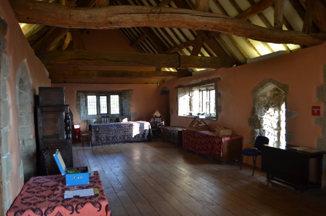
Image: © Ashley Dace Taken: 13 Nov 2011
The largest room in the house, the roof timbers have builders marks and holes for wooden poles. This is evidence that wattle and daub once split the room up into two.
Images are licensed for reuse under creativecommons.org/licenses/by-sa/2.0
Image Location
Latitude
52.709633
Longitude
-1.382001