Freeman House, Grimsby
Introduction
The photograph on this page of Freeman House, Grimsby by Stephen Richards as part of the Geograph project.
The Geograph project started in 2005 with the aim of publishing, organising and preserving representative images for every square kilometre of Great Britain, Ireland and the Isle of Man.

There are currently over 7.5m images from over 14,400 individuals and you can help contribute to the project by visiting https://www.geograph.org.uk
Freeman House, Grimsby
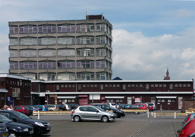
Image: © Stephen Richards Taken: 15 Jun 2011
A 1960s/1970s office block with a frame of ribbed concrete including tapering horizontal members. Currently occupied by North East Lincolnshire Council. At its feet is a shopping precinct which has seen better days (one hopes). Peeping up on the right is the Dock Tower (Image]).
Images are licensed for reuse under creativecommons.org/licenses/by-sa/2.0
Image Location
Latitude
53.573043
Longitude
-0.072806