Millwall Dock
Introduction
The photograph on this page of Millwall Dock by Marathon as part of the Geograph project.
The Geograph project started in 2005 with the aim of publishing, organising and preserving representative images for every square kilometre of Great Britain, Ireland and the Isle of Man.

There are currently over 7.5m images from over 14,400 individuals and you can help contribute to the project by visiting https://www.geograph.org.uk
Millwall Dock
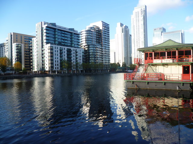
Image: © Marathon Taken: 9 Nov 2011
Millwall Dock was opened in 1868. The dock was used mainly for timber and grain, a trade which eventually moved down river to Tilbury. It is now dominated by offices and luxury flats. In this view, the structure on the right is a floating Chinese restaurant and the towers beyond cluster around Canary Wharf which is just hidden by the buildings in front of it.
Images are licensed for reuse under creativecommons.org/licenses/by-sa/2.0
Image Location


Leaflet Map data © OpenStreetMap
Latitude
51.497205
Longitude
-0.016401