Rushey Hall (Damems Farmhouse)
Introduction
The photograph on this page of Rushey Hall (Damems Farmhouse) by John Webb as part of the Geograph project.
The Geograph project started in 2005 with the aim of publishing, organising and preserving representative images for every square kilometre of Great Britain, Ireland and the Isle of Man.

There are currently over 7.5m images from over 14,400 individuals and you can help contribute to the project by visiting https://www.geograph.org.uk
Rushey Hall (Damems Farmhouse)
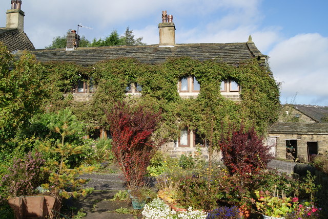
Image: © John Webb Taken: 30 Sep 2010
An interesting old farm house dating in part from the 1600s. Listed Grade II, see https://historicengland.org.uk/listing/the-list/list-entry/1134130?section=official-listing for the full description.
Images are licensed for reuse under creativecommons.org/licenses/by-sa/2.0
Image Location


Leaflet Map data © OpenStreetMap
Latitude
53.84623
Longitude
-1.929895