Cricklade: High Street
Introduction
The photograph on this page of Cricklade: High Street by Nigel Cox as part of the Geograph project.
The Geograph project started in 2005 with the aim of publishing, organising and preserving representative images for every square kilometre of Great Britain, Ireland and the Isle of Man.

There are currently over 7.5m images from over 14,400 individuals and you can help contribute to the project by visiting https://www.geograph.org.uk
Cricklade: High Street
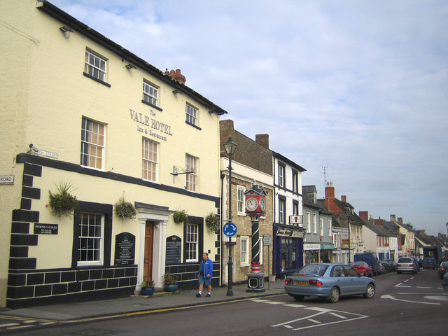
Image: © Nigel Cox Taken: 24 Oct 2006
This view was taken looking north along the High Street at its junction with the B4040 Calcutt Street. The Vale Hotel was originally the White Horse Inn, and there is a small but fine clock tower at the junction.
Images are licensed for reuse under creativecommons.org/licenses/by-sa/2.0
Image Location
Latitude
51.641115
Longitude
-1.856889