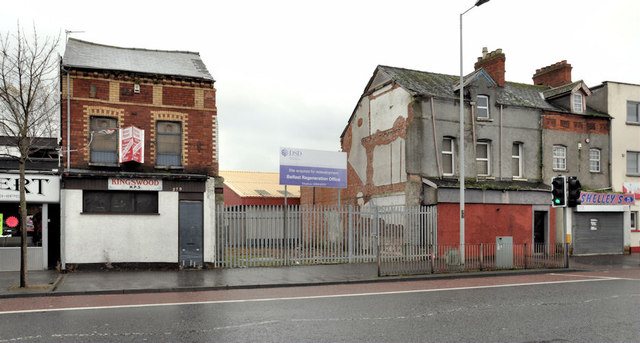
Regeneration site, east Belfast
Introduction
The photograph on this page of Regeneration site, east Belfast by Albert Bridge as part of the Geograph project.
The Geograph project started in 2005 with the aim of publishing, organising and preserving representative images for every square kilometre of Great Britain, Ireland and the Isle of Man.
There are currently over 7.5m images from over 14,400 individuals and you can help contribute to the project by visiting https://www.geograph.org.uk

Image: © Albert Bridge Taken: 8 Nov 2011
Over the last 25 (or so) years the private sector invested considerable amounts of money on prestige city centre Image, Laganside Image, Titanic Quarter Image and on suburban residential developments Image While there was public expenditure on new housing Image and Image many of the buildings fronting the Albertbridge and Newtownards Roads have fallen into a woeful state. This site, between Carnforth and Templemore Streets, off the former, has been acquired by the Department for Social Development as a “regeneration site”. Another one “The Skainos Project” http://www.skainos.org/ , on the Newtownards Road, is under construction.

