Ringneill Quay, Strangford Lough
Introduction
The photograph on this page of Ringneill Quay, Strangford Lough by Albert Bridge as part of the Geograph project.
The Geograph project started in 2005 with the aim of publishing, organising and preserving representative images for every square kilometre of Great Britain, Ireland and the Isle of Man.

There are currently over 7.5m images from over 14,400 individuals and you can help contribute to the project by visiting https://www.geograph.org.uk
Ringneill Quay, Strangford Lough
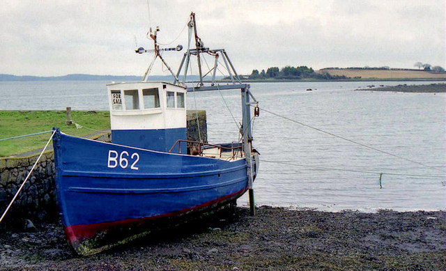
Image: © Albert Bridge Taken: 28 Mar 2005
See Image Seven months later the same fishing boat but with a discreet “for sale” sign inside the wheelhouse. Image (December 2012) shows the quay at close to high water.
Images are licensed for reuse under creativecommons.org/licenses/by-sa/2.0
Image Location
Latitude
54.513829
Longitude
-5.648903