Methodist church, Callington
Introduction
The photograph on this page of Methodist church, Callington by Derek Harper as part of the Geograph project.
The Geograph project started in 2005 with the aim of publishing, organising and preserving representative images for every square kilometre of Great Britain, Ireland and the Isle of Man.

There are currently over 7.5m images from over 14,400 individuals and you can help contribute to the project by visiting https://www.geograph.org.uk
Methodist church, Callington
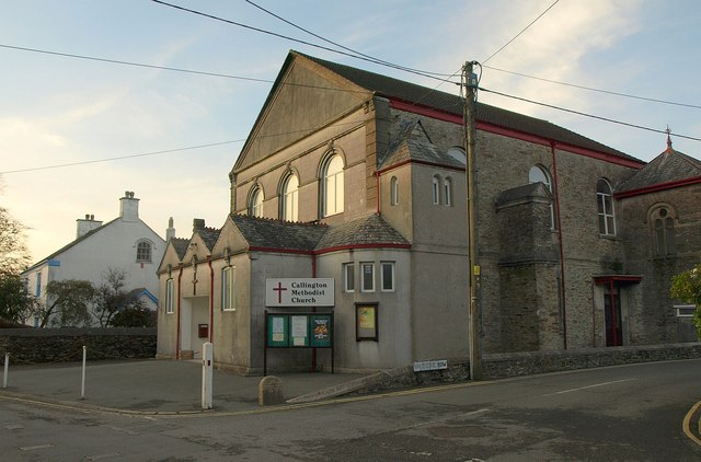
Image: © Derek Harper Taken: 1 Nov 2011
The Wesleyan Methodist church at the corner of Haye Road (left) and Valentine Row dates from 1845. To the right of the corner and the white post is the Borough Stone, marking the western boundary of the borough of Callington http://www.britishlistedbuildings.co.uk/en-61238-borough-stone-5-metres-to-south-east-of-w .
Images are licensed for reuse under creativecommons.org/licenses/by-sa/2.0
Image Location
Latitude
50.503461
Longitude
-4.317675