The Victoria
Introduction
The photograph on this page of The Victoria by Ian Capper as part of the Geograph project.
The Geograph project started in 2005 with the aim of publishing, organising and preserving representative images for every square kilometre of Great Britain, Ireland and the Isle of Man.

There are currently over 7.5m images from over 14,400 individuals and you can help contribute to the project by visiting https://www.geograph.org.uk
The Victoria
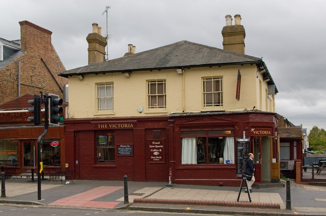
Image: © Ian Capper Taken: 4 Oct 2011
Licensed in 1872 as the Acorn, it was called the Clanned and then the Glass House in the late 2000s. After closure as the latter in 2009, it reopened in 2010 as the Victoria, presumably in recognition of its position on Victoria Street. It is locally listed.
Images are licensed for reuse under creativecommons.org/licenses/by-sa/2.0
Image Location
Latitude
51.750829
Longitude
-0.332465