The Lagan weir, Lisburn
Introduction
The photograph on this page of The Lagan weir, Lisburn by Albert Bridge as part of the Geograph project.
The Geograph project started in 2005 with the aim of publishing, organising and preserving representative images for every square kilometre of Great Britain, Ireland and the Isle of Man.

There are currently over 7.5m images from over 14,400 individuals and you can help contribute to the project by visiting https://www.geograph.org.uk
The Lagan weir, Lisburn
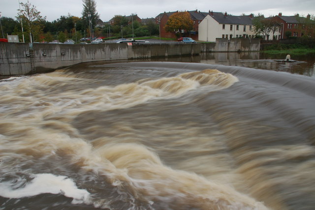
Image: © Albert Bridge Taken: 27 Oct 2006
See Image The canal bypassed this section of the River Lagan. This is the weir with the river swollen after some heavy rain over the previous two days. Hancock Street Image is visible at top right. Image shows the Lagan at a low summer level.
Images are licensed for reuse under creativecommons.org/licenses/by-sa/2.0
Image Location


Leaflet Map data © OpenStreetMap
Latitude
54.512859
Longitude
-6.032099