Burghersh Chantry
Introduction
The photograph on this page of Burghersh Chantry by Richard Croft as part of the Geograph project.
The Geograph project started in 2005 with the aim of publishing, organising and preserving representative images for every square kilometre of Great Britain, Ireland and the Isle of Man.

There are currently over 7.5m images from over 14,400 individuals and you can help contribute to the project by visiting https://www.geograph.org.uk
Burghersh Chantry
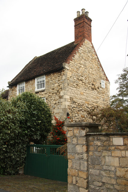
Image: © Richard Croft Taken: 10 Oct 2011
Former chantry house on James Street, now a private residence, with origins 1345 and later additions, extensively rebuilt after a fire in 1965
Images are licensed for reuse under creativecommons.org/licenses/by-sa/2.0
Image Location


Leaflet Map data © OpenStreetMap
Latitude
53.235863
Longitude
-0.536757