Lliedi resurfaces
Introduction
The photograph on this page of Lliedi resurfaces by Hywel Williams as part of the Geograph project.
The Geograph project started in 2005 with the aim of publishing, organising and preserving representative images for every square kilometre of Great Britain, Ireland and the Isle of Man.

There are currently over 7.5m images from over 14,400 individuals and you can help contribute to the project by visiting https://www.geograph.org.uk
Lliedi resurfaces
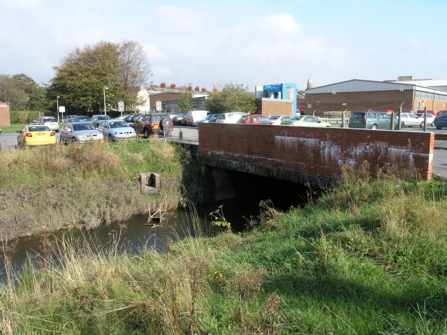
Image: © Hywel Williams Taken: 18 Oct 2006
This is the point where the river Lliedi re-emerges after travelling for about 700m underground through the centre of Llanelli. Much of Llanelli is very near sea level and about 20m downstream, the river starts to be influenced by normal high tides.
Images are licensed for reuse under creativecommons.org/licenses/by-sa/2.0
Image Location


Leaflet Map data © OpenStreetMap
Latitude
51.679603
Longitude
-4.169533