Damaged benchmark on #1 East Dale Street
Introduction
The photograph on this page of Damaged benchmark on #1 East Dale Street by Roger Templeman as part of the Geograph project.
The Geograph project started in 2005 with the aim of publishing, organising and preserving representative images for every square kilometre of Great Britain, Ireland and the Isle of Man.

There are currently over 7.5m images from over 14,400 individuals and you can help contribute to the project by visiting https://www.geograph.org.uk
Damaged benchmark on #1 East Dale Street
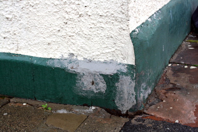
Image: © Roger Templeman Taken: 7 Aug 2011
The house owners appear to trying to destroy this Ordnance Survey pivot benchmark which is described on the Bench Mark Database at http://www.bench-marks.org.uk/bm39014
Images are licensed for reuse under creativecommons.org/licenses/by-sa/2.0
Image Location
Latitude
54.885021
Longitude
-2.9407