All Saints Parish Church, Cotgrave
Introduction
The photograph on this page of All Saints Parish Church, Cotgrave by Alan Murray-Rust as part of the Geograph project.
The Geograph project started in 2005 with the aim of publishing, organising and preserving representative images for every square kilometre of Great Britain, Ireland and the Isle of Man.

There are currently over 7.5m images from over 14,400 individuals and you can help contribute to the project by visiting https://www.geograph.org.uk
All Saints Parish Church, Cotgrave
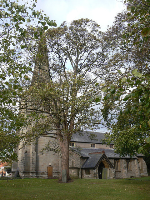
Image: © Alan Murray-Rust Taken: 20 Oct 2011
In view of the coverage in Geograph of medieval churches around England, it surprising that it has taken until 2011 for this one to appear, although as this picture shows, it is not easy to photograph. The church dates back to at least the 12th century, from which period the chancel arch survives, with medieval fabric from 13th, 14th and 15th centuries as well. The church suffered a catastrophic arson attack in 1996 resulting in the destruction of the nave roof. The church is Listed Grade I, although the listing has not been updated since the fire. For details of the church, the best source I have found is http://southwellchurches.nottingham.ac.uk/cotgrave/hintro.php
Images are licensed for reuse under creativecommons.org/licenses/by-sa/2.0
Image Location
Latitude
52.911637
Longitude
-1.043802