Dale Farm Wetton Mill
Introduction
The photograph on this page of Dale Farm Wetton Mill by Dennis Thorley as part of the Geograph project.
The Geograph project started in 2005 with the aim of publishing, organising and preserving representative images for every square kilometre of Great Britain, Ireland and the Isle of Man.

There are currently over 7.5m images from over 14,400 individuals and you can help contribute to the project by visiting https://www.geograph.org.uk
Dale Farm Wetton Mill
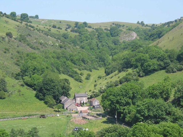
Image: © Dennis Thorley Taken: 27 Jun 2005
Dale Farm is in typical limestone country with Sugar Loaf visible in the rising, dry, valley behind. Except in the rainiest of seasons the river Manifold disappears underground between Wetton Mill and Dafar Bridge to emerge once again in the grounds of Ilam Hall.
Images are licensed for reuse under creativecommons.org/licenses/by-sa/2.0
Image Location


Leaflet Map data © OpenStreetMap
Latitude
53.103453
Longitude
-1.859411