Ardgate Farm
Introduction
The photograph on this page of Ardgate Farm by Lairich Rig as part of the Geograph project.
The Geograph project started in 2005 with the aim of publishing, organising and preserving representative images for every square kilometre of Great Britain, Ireland and the Isle of Man.

There are currently over 7.5m images from over 14,400 individuals and you can help contribute to the project by visiting https://www.geograph.org.uk
Ardgate Farm
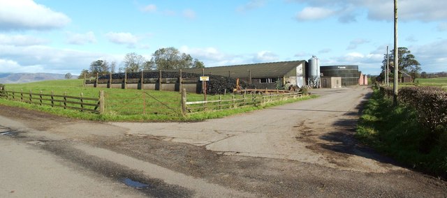
Image: © Lairich Rig Taken: 19 Oct 2011
The farm is located beside Image, which leads from the Horseshoe to the village of Gartocharn. According to a lady whom I met on the day, the name of the farm was changed to avoid confusion with nearby Image This is borne out by early OS maps: the first-edition map (surveyed c.1860) calls this farm West Caldarvan, and it is shown by that name until at least the 1950s (although it is possible that the name change took place earlier, and that the maps did not immediately reflect it). After that, the present-day name Ardgate is shown. For another view of the farm, see Image
Images are licensed for reuse under creativecommons.org/licenses/by-sa/2.0
Image Location
Latitude
56.027949
Longitude
-4.521274