Where's the path?
Introduction
The photograph on this page of Where's the path? by Roger Jones as part of the Geograph project.
The Geograph project started in 2005 with the aim of publishing, organising and preserving representative images for every square kilometre of Great Britain, Ireland and the Isle of Man.

There are currently over 7.5m images from over 14,400 individuals and you can help contribute to the project by visiting https://www.geograph.org.uk
Where's the path?
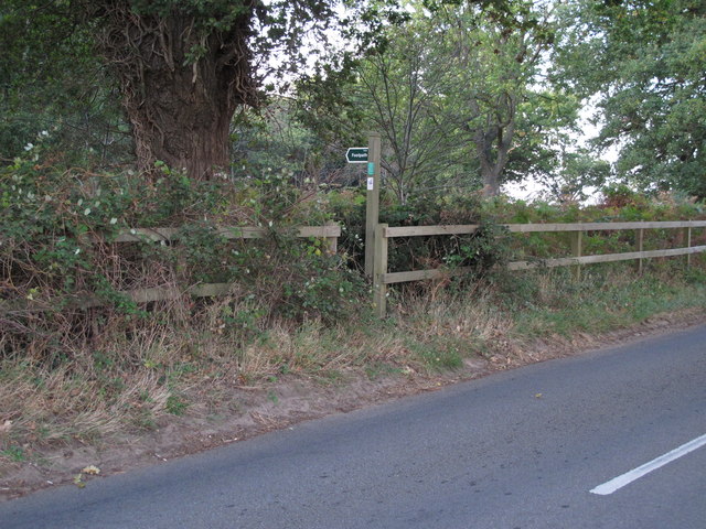
Image: © Roger Jones Taken: 23 Oct 2011
The footpath and marker is about 100m NE of the line shown on the OS 25K (online) map. Indeed the footpath as a whole through The Thicks is a few yards east of the line shown, as I found out when in the dense undergrowth with my phone displaying my position.
Images are licensed for reuse under creativecommons.org/licenses/by-sa/2.0
Image Location
Latitude
52.101678
Longitude
1.449616