Surrey Canal Road
Introduction
The photograph on this page of Surrey Canal Road by Malc McDonald as part of the Geograph project.
The Geograph project started in 2005 with the aim of publishing, organising and preserving representative images for every square kilometre of Great Britain, Ireland and the Isle of Man.

There are currently over 7.5m images from over 14,400 individuals and you can help contribute to the project by visiting https://www.geograph.org.uk
Surrey Canal Road
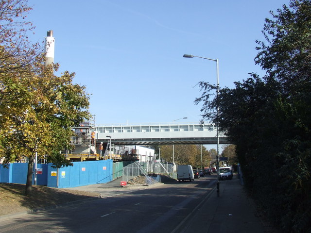
Image: © Malc McDonald Taken: 22 Oct 2011
This new bridge over Surrey Canal Road was installed in October 2011. It will carry an extension of London Overground's East London Line. The extension, which is due to open in 2012, will enable East London Line trains to run via Peckham Rye to Clapham Junction. There was previously a footbridge across Surrey Canal Road at this point. A photo of the footbridge is here: Image The road here was formerly a canal, which was used primarily for transporting timber. The canal ran from the River Thames to Camberwell with a branch to Peckham.
Images are licensed for reuse under creativecommons.org/licenses/by-sa/2.0
Image Location
Latitude
51.484359
Longitude
-0.049365