A Telford milestone (Holyhead 30), Bethesda
Introduction
The photograph on this page of A Telford milestone (Holyhead 30), Bethesda by Meirion as part of the Geograph project.
The Geograph project started in 2005 with the aim of publishing, organising and preserving representative images for every square kilometre of Great Britain, Ireland and the Isle of Man.

There are currently over 7.5m images from over 14,400 individuals and you can help contribute to the project by visiting https://www.geograph.org.uk
A Telford milestone (Holyhead 30), Bethesda
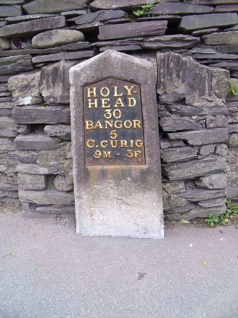
Image: © Meirion Taken: 23 Sep 2011
This is one of Thomas Telford's milestones located along the original London - Holyhead Road (A5). This one indicates that Holyhead is 30 miles away. This milestone is also inscribed with a cut mark benchmark which is recorded in the Ordnance Survey database at a height of 147.0874m above the Newlyn datum. See also Image
Images are licensed for reuse under creativecommons.org/licenses/by-sa/2.0
Image Location
Latitude
53.176459
Longitude
-4.057583