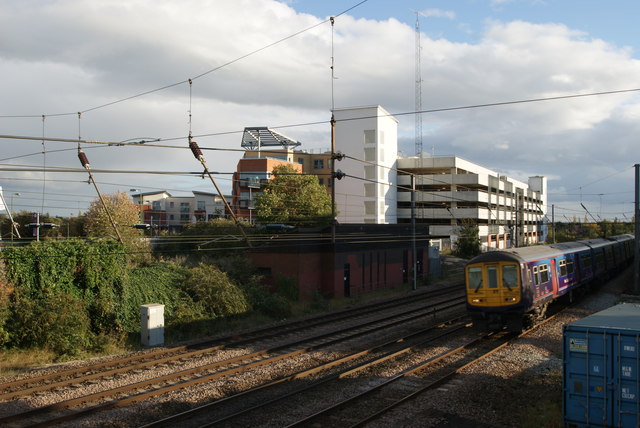
The Multistorey carpark and flats near St Albans City station
Introduction
The photograph on this page of The Multistorey carpark and flats near St Albans City station by John Webb as part of the Geograph project.
The Geograph project started in 2005 with the aim of publishing, organising and preserving representative images for every square kilometre of Great Britain, Ireland and the Isle of Man.
There are currently over 7.5m images from over 14,400 individuals and you can help contribute to the project by visiting https://www.geograph.org.uk

Image: © John Webb Taken: 19 Oct 2011
The multi-storey car park opened in 2008. Built on the site of the former St Albans engine shed, which was demolished in 1965. The part of the building to the left of the tower containing the stairs and lifts is a block of flats which form one side of this complex. Just to the left of this is the roof of a new block of flats, just completed and not yet on the maps. The long low redbrick building in the middle of the photograph is a relay room controlling signals in the St Albans City station area from the power signal box at West Hampstead. On the Down Fast line a 319 unit approaches St Albans City station. This photo was taken from the top of the stairs at the preserved St Albans South signal box. (See Image)

