St Mary's church tower, Bitton
Introduction
The photograph on this page of St Mary's church tower, Bitton by Neil Owen as part of the Geograph project.
The Geograph project started in 2005 with the aim of publishing, organising and preserving representative images for every square kilometre of Great Britain, Ireland and the Isle of Man.

There are currently over 7.5m images from over 14,400 individuals and you can help contribute to the project by visiting https://www.geograph.org.uk
St Mary's church tower, Bitton
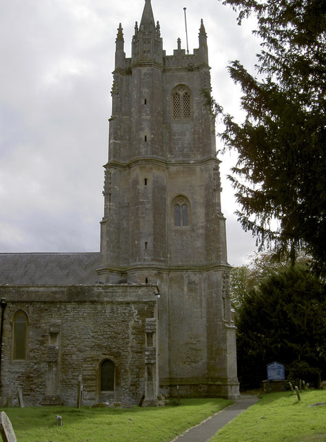
Image: © Neil Owen Taken: 17 Oct 2011
First built in 1377, this fine tower has survived Cromwell's army and lightning, which struck in 1680 and destroyed the single spirette. Located at the base is a cut benchmark - see http://www.bench-marks.org.uk/bm39805 for the listing. See also Image] for a wider view of the north side of the church.
Images are licensed for reuse under creativecommons.org/licenses/by-sa/2.0
Image Location
Latitude
51.422081
Longitude
-2.459014