Footbridge connecting North and South Worple Ways
Introduction
The photograph on this page of Footbridge connecting North and South Worple Ways by Stefan Czapski as part of the Geograph project.
The Geograph project started in 2005 with the aim of publishing, organising and preserving representative images for every square kilometre of Great Britain, Ireland and the Isle of Man.

There are currently over 7.5m images from over 14,400 individuals and you can help contribute to the project by visiting https://www.geograph.org.uk
Footbridge connecting North and South Worple Ways
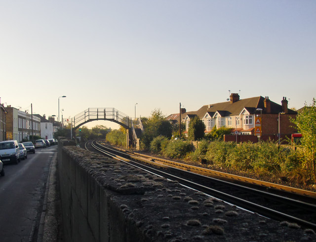
Image: © Stefan Czapski Taken: 14 Oct 2011
Approaching Mortlake station from the east, the railway is flanked by two narrow streets running parallel to it. South Worple Way is built up only on its south side, North Worple Way only on its north side. In order to get a view over the high wall, I held the camera above my head, at full stretch.
Images are licensed for reuse under creativecommons.org/licenses/by-sa/2.0
Image Location
Latitude
51.467622
Longitude
-0.26014