Where it all began!
Introduction
The photograph on this page of Where it all began! by Rod Allday as part of the Geograph project.
The Geograph project started in 2005 with the aim of publishing, organising and preserving representative images for every square kilometre of Great Britain, Ireland and the Isle of Man.

There are currently over 7.5m images from over 14,400 individuals and you can help contribute to the project by visiting https://www.geograph.org.uk
Where it all began!
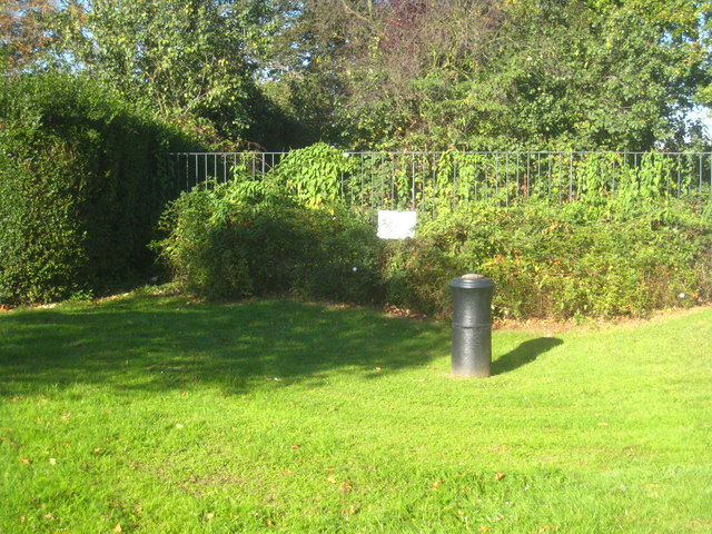
Image: © Rod Allday Taken: 15 Oct 2011
This cannon embedded in the ground in Roy Grove marks the south eastern end of General Roy's original base line for setting out the Ordnance Survey triangulation of Great Britain in 1784. The white plaque in the background was put in place in 1926 to mark the 200th anniversary of General Roy's birth. The north western end of the base line is at Heathrow, on the other side of what was at the time Hounslow Heath Image
Images are licensed for reuse under creativecommons.org/licenses/by-sa/2.0
Image Location
Latitude
51.426429
Longitude
-0.365848