Albion Channel
Introduction
The photograph on this page of Albion Channel by Marathon as part of the Geograph project.
The Geograph project started in 2005 with the aim of publishing, organising and preserving representative images for every square kilometre of Great Britain, Ireland and the Isle of Man.

There are currently over 7.5m images from over 14,400 individuals and you can help contribute to the project by visiting https://www.geograph.org.uk
Albion Channel
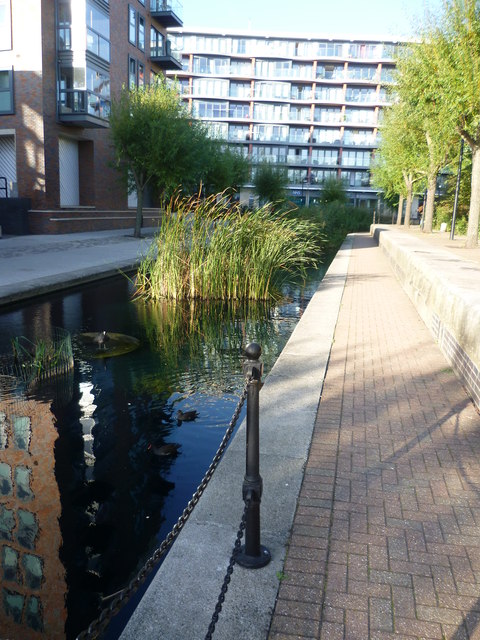
Image: © Marathon Taken: 14 Oct 2011
The Surrey Commercial Docks originated in 1696 and expanded over the next two centuries. Several of the docks were named after the origins of their customers' cargoes, hence Canada Dock, Quebec Pond, Norway Dock and Russia Dock. The Surrey Commercial Docks finally closed for lack of custom in 1969. About half of Canada Dock was infilled and the Surrey Quays Shopping Centre built on top of it; the remainder was converted into the present lake and wildlife refuge and renamed Canada Water. An ornamental canal, Albion Channel, was created through the site of the now filled-in Albion Dock to link Canada Water to Surrey Water, with the spoil used to create the nearby Stave Hill. This is looking along Albion Channel from its inlet by Canada Water. There are several bends and bridges along its course and it provides a pleasant outlook for the neighbouring flats.
Images are licensed for reuse under creativecommons.org/licenses/by-sa/2.0
Image Location
Latitude
51.498178
Longitude
-0.047623