38 - 42 St Peter's Street
Introduction
The photograph on this page of 38 - 42 St Peter's Street by Ian Capper as part of the Geograph project.
The Geograph project started in 2005 with the aim of publishing, organising and preserving representative images for every square kilometre of Great Britain, Ireland and the Isle of Man.

There are currently over 7.5m images from over 14,400 individuals and you can help contribute to the project by visiting https://www.geograph.org.uk
38 - 42 St Peter's Street
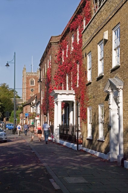
Image: © Ian Capper Taken: 2 Oct 2011
A group of 18th century houses towards the northern end of the main part of St Peter's Street. Nearest is No 38, followed by Nos 40 (the one covered in Virginia Creeper with the porch - originally called Donnington House, now Mallinson House) and 42. All three are grade II listed - for listing particulars see www.historicengland.org.uk/listing/the-list/list-entry/1174138, www.historicengland.org.uk/listing/the-list/list-entry/1347164 and www.historicengland.org.uk/listing/the-list/list-entry/1103055 respectively. Together they house the headquarters of the National Pharmacy Association. In the background is the tower of St Peter's Church.
Images are licensed for reuse under creativecommons.org/licenses/by-sa/2.0
Image Location
Latitude
51.754168
Longitude
-0.336457