Musbury: milestone on Axminster Road
Introduction
The photograph on this page of Musbury: milestone on Axminster Road by Chris Downer as part of the Geograph project.
The Geograph project started in 2005 with the aim of publishing, organising and preserving representative images for every square kilometre of Great Britain, Ireland and the Isle of Man.

There are currently over 7.5m images from over 14,400 individuals and you can help contribute to the project by visiting https://www.geograph.org.uk
Musbury: milestone on Axminster Road
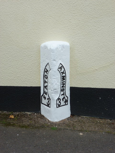
Image: © Chris Downer Taken: 10 Oct 2011
This milestone is set flush against a cottage just to the north of the village centre and has the names of Seaton and Axminster ornately embossed on metal plates. It is equidistant from the two towns.
Images are licensed for reuse under creativecommons.org/licenses/by-sa/2.0
Image Location
Latitude
50.747887
Longitude
-3.030132