Pond in Brockwell Park
Introduction
The photograph on this page of Pond in Brockwell Park by Marathon as part of the Geograph project.
The Geograph project started in 2005 with the aim of publishing, organising and preserving representative images for every square kilometre of Great Britain, Ireland and the Isle of Man.

There are currently over 7.5m images from over 14,400 individuals and you can help contribute to the project by visiting https://www.geograph.org.uk
Pond in Brockwell Park
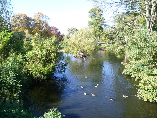
Image: © Marathon Taken: 28 Sep 2011
The three ponds along the western side of Brockwell Park follow the line of the lost River Effra. The line of the Effra can be seen below the lowest of the ponds - see http://www.geograph.org.uk/photo/2636375. Presumably these ponds were formed by damming the river. The upper reaches of the River Effra remained clean and open well into the 19th century. In 1860 it was still "an open, clear, and sparkling brook" which ran "over a gravelly bottom through the fields and supplied fresh water to the neighbourhood". By the end of the 19th century it had all been bricked over. Apart from this stream and the ponds in Brockwell Park, only valleys such as the one which Leigham Vale follows - see http://www.geograph.org.uk/photo/2052759 , air vents as in Brockwell Park near Rosendale Road, and names such as Brixton Water Lane indicate where the Effra flows.
Images are licensed for reuse under creativecommons.org/licenses/by-sa/2.0
Image Location
Latitude
51.450022
Longitude
-0.110701