Sopwell Lane
Introduction
The photograph on this page of Sopwell Lane by Ian Capper as part of the Geograph project.
The Geograph project started in 2005 with the aim of publishing, organising and preserving representative images for every square kilometre of Great Britain, Ireland and the Isle of Man.

There are currently over 7.5m images from over 14,400 individuals and you can help contribute to the project by visiting https://www.geograph.org.uk
Sopwell Lane
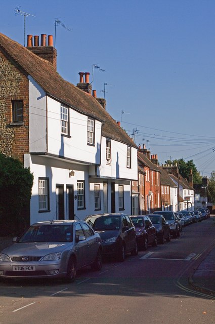
Image: © Ian Capper Taken: 2 Oct 2011
The old route into St Albans from London, as a continuation of Old London Road, until the building of the current London Road by Thomas Telford in the late 18th century. All the buildings on the north side of the road are either grade II listed or locally listed, reflecting its historic importance and its preservation as a medieval route. In particular the nearest range of buildings in this photo, nos 63 - 69, dates from the 16th century and is grade II listed - see www.historicengland.org.uk/listing/the-list/list-entry/1174493 while the house beyond, no 71, dates from the 18th century and is also grade II listed - see www.historicengland.org.uk/listing/the-list/list-entry/1347168.
Images are licensed for reuse under creativecommons.org/licenses/by-sa/2.0
Image Location
Latitude
51.748374
Longitude
-0.338133