Fishpond Cottages
Introduction
The photograph on this page of Fishpond Cottages by Martyn Pattison as part of the Geograph project.
The Geograph project started in 2005 with the aim of publishing, organising and preserving representative images for every square kilometre of Great Britain, Ireland and the Isle of Man.

There are currently over 7.5m images from over 14,400 individuals and you can help contribute to the project by visiting https://www.geograph.org.uk
Fishpond Cottages
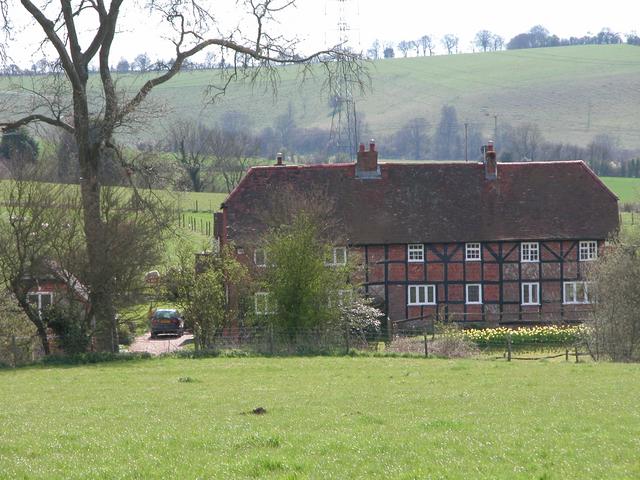
Image: © Martyn Pattison Taken: 11 Apr 2005
17th C Timber-framed cottages, with mainly herringbone brick infilling at front, some malmstone at the sides, which are partly tile-hung. Double hipped tiled roof.
Images are licensed for reuse under creativecommons.org/licenses/by-sa/2.0
Image Location


Leaflet Map data © OpenStreetMap
Latitude
50.988715
Longitude
-1.011175