Canterbury, King's Bridge
Introduction
The photograph on this page of Canterbury, King's Bridge by Helmut Zozmann as part of the Geograph project.
The Geograph project started in 2005 with the aim of publishing, organising and preserving representative images for every square kilometre of Great Britain, Ireland and the Isle of Man.

There are currently over 7.5m images from over 14,400 individuals and you can help contribute to the project by visiting https://www.geograph.org.uk
Canterbury, King's Bridge
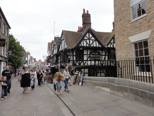
Image: © Helmut Zozmann Taken: 28 Jul 2011
Canterbury, King's Bridge looking down St Peter's Street. The timberframed house on the right hand is "The Old Weavers Restaurant", 1 St Peters Street, CT1 2DH. Although it says 1500 on the sign, this date does not give a very accurate description of the building. Originally this is the site of an Old Kentish Hall a few centuries prior to the 16th century, but most of what you can see today dates from near the end of the 16th century (not the beginning).
Images are licensed for reuse under creativecommons.org/licenses/by-sa/2.0
Image Location
Latitude
51.279917
Longitude
1.078282