Corporation Street (part), Belfast (2011)
Introduction
The photograph on this page of Corporation Street (part), Belfast (2011) by Albert Bridge as part of the Geograph project.
The Geograph project started in 2005 with the aim of publishing, organising and preserving representative images for every square kilometre of Great Britain, Ireland and the Isle of Man.

There are currently over 7.5m images from over 14,400 individuals and you can help contribute to the project by visiting https://www.geograph.org.uk
Corporation Street (part), Belfast (2011)
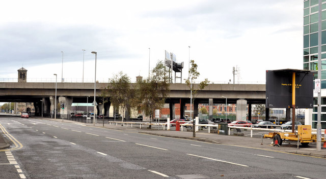
Image: © Albert Bridge Taken: 8 Oct 2011
See Image A similar view in 2011 with the M3 Image and the railway to Yorkgate Image crossing the middle of the photograph. The common reference points are Sinclair Seaman’s church Image (middle left) and the Design Centre Image (right). Exchange Street Image is at the lower left.
Images are licensed for reuse under creativecommons.org/licenses/by-sa/2.0
Image Location
Latitude
54.603333
Longitude
-5.924351