Model Dam Information, Building Research
Introduction
The photograph on this page of Model Dam Information, Building Research by John Webb as part of the Geograph project.
The Geograph project started in 2005 with the aim of publishing, organising and preserving representative images for every square kilometre of Great Britain, Ireland and the Isle of Man.

There are currently over 7.5m images from over 14,400 individuals and you can help contribute to the project by visiting https://www.geograph.org.uk
Model Dam Information, Building Research
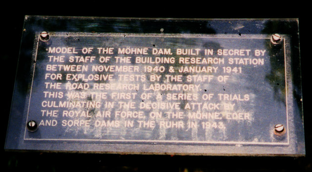
Image: © John Webb Taken: Unknown
Near the dam pictured in Image is a short explanatory information board, shown here. This simple sign has since been replaced - see Image
Images are licensed for reuse under creativecommons.org/licenses/by-sa/2.0
Image Location
Latitude
51.701712
Longitude
-0.374618