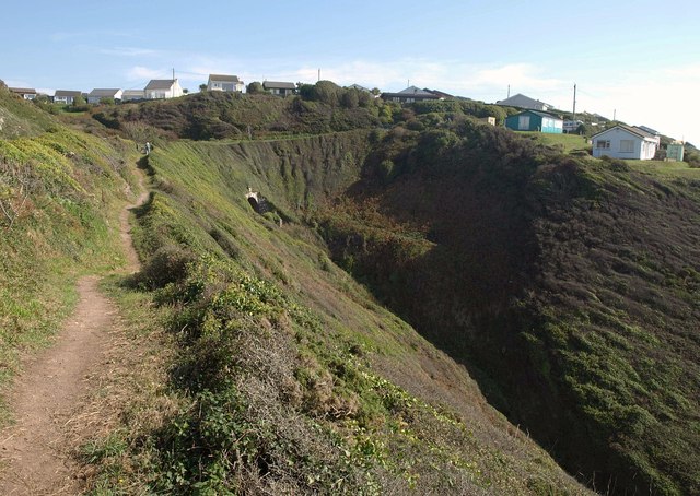
Valley at Freathy
Introduction
The photograph on this page of Valley at Freathy by Derek Harper as part of the Geograph project.
The Geograph project started in 2005 with the aim of publishing, organising and preserving representative images for every square kilometre of Great Britain, Ireland and the Isle of Man.
There are currently over 7.5m images from over 14,400 individuals and you can help contribute to the project by visiting https://www.geograph.org.uk

Image: © Derek Harper Taken: 1 Oct 2011
The coast path approaches this steep ravine on the west edge of the settlement. Freathy, on the far side, is well described at http://www.jbutler.org.uk/e2e/sccp/w15/index.shtml : "an entire community of holiday chalets, huts and shacks, in a seemingly random layout ... There are two schools of thought about Freathy - it's either a place of unique charm or it's an unsightly, ramshackle mess. You decide." On this sunny day, I tended towards the former, though the settlement lacks any of the facilities you might expect in a village.
Image Location


