The Bridgewater Canal Junction, Preston Brook, Cheshire
Introduction
The photograph on this page of The Bridgewater Canal Junction, Preston Brook, Cheshire by Roger D Kidd as part of the Geograph project.
The Geograph project started in 2005 with the aim of publishing, organising and preserving representative images for every square kilometre of Great Britain, Ireland and the Isle of Man.

There are currently over 7.5m images from over 14,400 individuals and you can help contribute to the project by visiting https://www.geograph.org.uk
The Bridgewater Canal Junction, Preston Brook, Cheshire
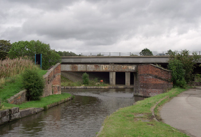
Image: © Roger D Kidd Taken: 29 Aug 2011
This is the Norton arm of the canal from Runcorn approaching the main line. To the left is Manchester, and to the right is the link to the Trent and Mersey Canal via Preston Brook Tunnel. The near bridge carries the towpath across the branch, and the larger concrete bridge beyond carries the M56 motorway.
Images are licensed for reuse under creativecommons.org/licenses/by-sa/2.0
Image Location
Latitude
53.324146
Longitude
-2.651952