Eastwell Hall
Introduction
The photograph on this page of Eastwell Hall by John Sutton as part of the Geograph project.
The Geograph project started in 2005 with the aim of publishing, organising and preserving representative images for every square kilometre of Great Britain, Ireland and the Isle of Man.

There are currently over 7.5m images from over 14,400 individuals and you can help contribute to the project by visiting https://www.geograph.org.uk
Eastwell Hall
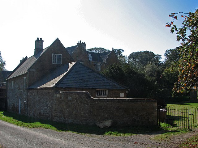
Image: © John Sutton Taken: 30 Sep 2011
“Façade of three wide bays with two big shaped gables. The windows sashed, the doorway also of the C18” (Nikolaus Pevsner). Eastwell Hall was built c. 1630 by a recusant Catholic family, the Eyres of Hassop in Derbyshire. It became part of the Belvoir Estate from 1792 until 1921. As late as 1780 Eastwell had the largest Catholic population in the county, apart from Leicester, and a Catholic Chapel was built nearby in 1798, replacing one at the Hall closed by the Duke of Rutland. The house is largely hidden from the road and the picture was taken against strong morning sunlight during the heat wave at the end of September 2011.
Images are licensed for reuse under creativecommons.org/licenses/by-sa/2.0
Image Location
Latitude
52.848963
Longitude
-0.849466