Dover, Market Square
Introduction
The photograph on this page of Dover, Market Square by Helmut Zozmann as part of the Geograph project.
The Geograph project started in 2005 with the aim of publishing, organising and preserving representative images for every square kilometre of Great Britain, Ireland and the Isle of Man.

There are currently over 7.5m images from over 14,400 individuals and you can help contribute to the project by visiting https://www.geograph.org.uk
Dover, Market Square
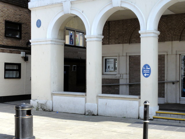
Image: © Helmut Zozmann Taken: 24 Jul 2011
Dover, Market Square, Market Hall in Dover, on the south-western side of Market Square. The alleyway with the brick building on the left hand side is Gaol Lane. The Market Hall was bomb damaged in the Second World War and the façade on the north eastern corner was reduced to just the ground floor. A public convenience was built in this damaged section, and was there in the 1980s, behind two telephone boxes. The telephone boxes and the public conveniences have disappeared when in the 1990s, the old Market Hall site was rebuilt as the White Cliffs Experience Heritage Centre - the northern façade on Market Square was reconstructed and the rest of the building replaced. The building is now Dover Museum. Image
Images are licensed for reuse under creativecommons.org/licenses/by-sa/2.0
Image Location
Latitude
51.124718
Longitude
1.313228