CB1 taking shape
Introduction
The photograph on this page of CB1 taking shape by John Sutton as part of the Geograph project.
The Geograph project started in 2005 with the aim of publishing, organising and preserving representative images for every square kilometre of Great Britain, Ireland and the Isle of Man.

There are currently over 7.5m images from over 14,400 individuals and you can help contribute to the project by visiting https://www.geograph.org.uk
CB1 taking shape
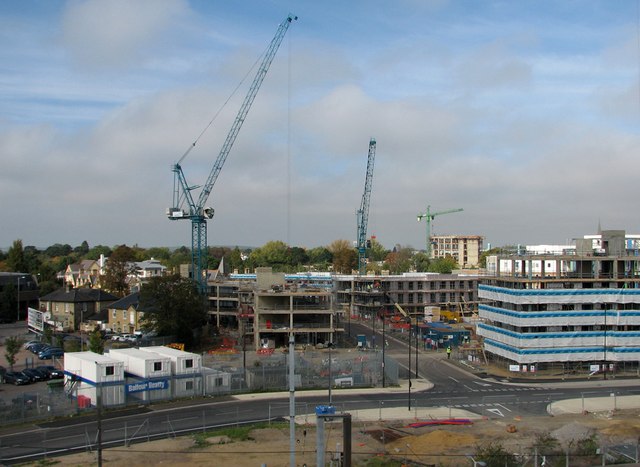
Image: © John Sutton Taken: 27 Sep 2011
Student flats are being built on former railway land south of Cambridge Station. The Earl of Derby pub on Hills Road (extreme left) is one of the few older buildings left in this area. The busway route crosses the picture, which was taken from the top storey of the Cambridge Leisure car park.
Images are licensed for reuse under creativecommons.org/licenses/by-sa/2.0
Image Location


Leaflet Map data © OpenStreetMap
Latitude
52.19227
Longitude
0.13481