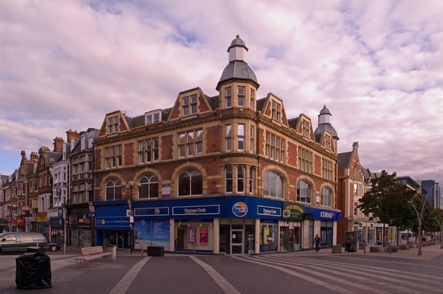
Junction of High Street and Station Road
Introduction
The photograph on this page of Junction of High Street and Station Road by Ian Capper as part of the Geograph project.
The Geograph project started in 2005 with the aim of publishing, organising and preserving representative images for every square kilometre of Great Britain, Ireland and the Isle of Man.
There are currently over 7.5m images from over 14,400 individuals and you can help contribute to the project by visiting https://www.geograph.org.uk

Image: © Ian Capper Taken: 29 Aug 2011
Station Road on the left, High Street on the right. This was once the main Redhill crossroads, although now pedestrianised. The building in the centre of the photo was built in the early 1900s to a near identical external design of a previous building which had only opened in 1900, but which had been destroyed in a major fire which took place on 25 May 1901, the worst in Redhill's history. It was occupied by R Nicol and Sons, Drapers and Furnishers, until 1933. Compare Image and note the change of use from a year earlier. The next building to its left, now occupied by a cycle shop, was an early branch of Sainsbury's - see http://www.francisfrith.com/redhill,surrey/photos/station-road-east-1906_55033/ for a photo in 1906.

