Balloons and Hangars, Cardington, 1979
Introduction
The photograph on this page of Balloons and Hangars, Cardington, 1979 by John Webb as part of the Geograph project.
The Geograph project started in 2005 with the aim of publishing, organising and preserving representative images for every square kilometre of Great Britain, Ireland and the Isle of Man.

There are currently over 7.5m images from over 14,400 individuals and you can help contribute to the project by visiting https://www.geograph.org.uk
Balloons and Hangars, Cardington, 1979
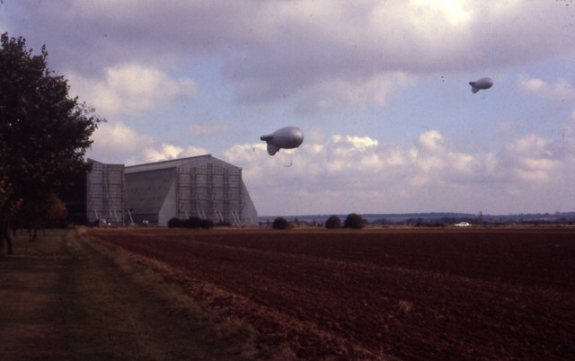
Image: © John Webb Taken: Unknown
Balloons, similar to the war-time barrage balloons, being used by the Meteorological Office experimental unit based at Cardington in Hangar 1 on the left, partly hidden by the tree. Hangar No.2 on the right was then being used by the Fire Research Station based at Borehamwood (see Image) for large-scale fire and explosion tests that could not be carried out at Borehamwood. (Photo scanned directly from a High-speed Ektachrome 35mm slide.)
Images are licensed for reuse under creativecommons.org/licenses/by-sa/2.0
Image Location
Latitude
52.107207
Longitude
-0.425334