Milestone, Dromore
Introduction
The photograph on this page of Milestone, Dromore by Albert Bridge as part of the Geograph project.
The Geograph project started in 2005 with the aim of publishing, organising and preserving representative images for every square kilometre of Great Britain, Ireland and the Isle of Man.

There are currently over 7.5m images from over 14,400 individuals and you can help contribute to the project by visiting https://www.geograph.org.uk
Milestone, Dromore
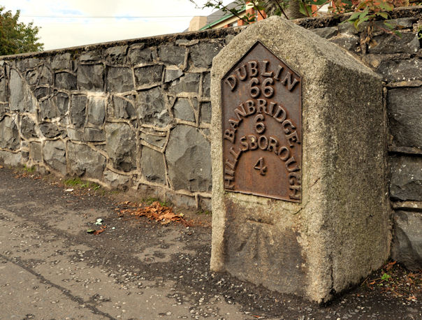
Image: © Albert Bridge Taken: 23 Sep 2011
A milestone, on the Banbridge Road, showing the distances in Irish miles. The road was once part of a turnpike and also on the route used by the Belfast – Dublin mail coaches. There is also a cut bench mark on the bottom of the milestone, levelled to 74.02 metres above MSL.
Images are licensed for reuse under creativecommons.org/licenses/by-sa/2.0
Image Location
Latitude
54.413491
Longitude
-6.151937