Warrior public house (site of)
Introduction
The photograph on this page of Warrior public house (site of) by Chris Lordan as part of the Geograph project.
The Geograph project started in 2005 with the aim of publishing, organising and preserving representative images for every square kilometre of Great Britain, Ireland and the Isle of Man.

There are currently over 7.5m images from over 14,400 individuals and you can help contribute to the project by visiting https://www.geograph.org.uk
Warrior public house (site of)
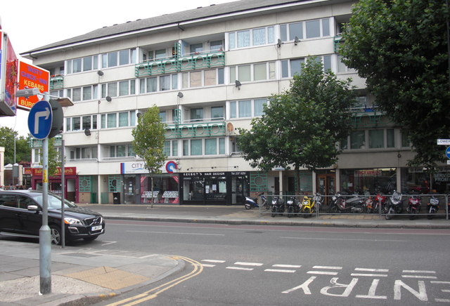
Image: © Chris Lordan Taken: 17 Aug 2011
Site of what was 209 Lower Road, Rotherhithe, SE16 junction with Maynard Road and opposite Cope Street. Opened in 1862 as the 'Manor Beer House' and closed with the building of the Osprey Estate in the early 1970s. Warrior II (now Surrey Docks pub) was built about 50 yards to the left at the junction with Redriff Road. Image shows Tawny Way of the Osprey Estate.
Images are licensed for reuse under creativecommons.org/licenses/by-sa/2.0
Image Location
Latitude
51.492578
Longitude
-0.046133