Rheola Bridge, Porth
Introduction
The photograph on this page of Rheola Bridge, Porth by Jaggery as part of the Geograph project.
The Geograph project started in 2005 with the aim of publishing, organising and preserving representative images for every square kilometre of Great Britain, Ireland and the Isle of Man.

There are currently over 7.5m images from over 14,400 individuals and you can help contribute to the project by visiting https://www.geograph.org.uk
Rheola Bridge, Porth
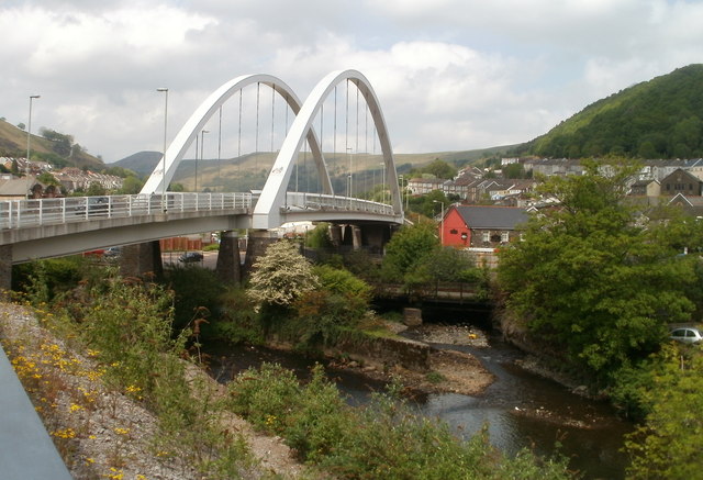
Image: © Jaggery Taken: 6 May 2011
The Rheola Bridge was made with 1,100 tonnes of structural steel. It crosses the Rhondda River at the confluence of the two Rhonddas, http://www.geograph.org.uk/photo/2612325 and the Rhondda Line railway. It was built as part of the £98 million Porth relief road project, and is one of 11 bridges that were built or replaced during the project. The relief road was opened to traffic in December 2006. Landscaping continued into 2007.
Images are licensed for reuse under creativecommons.org/licenses/by-sa/2.0
Image Location
Latitude
51.613838
Longitude
-3.410984