Confluence of the Rhonddas, Porth
Introduction
The photograph on this page of Confluence of the Rhonddas, Porth by Jaggery as part of the Geograph project.
The Geograph project started in 2005 with the aim of publishing, organising and preserving representative images for every square kilometre of Great Britain, Ireland and the Isle of Man.

There are currently over 7.5m images from over 14,400 individuals and you can help contribute to the project by visiting https://www.geograph.org.uk
Confluence of the Rhonddas, Porth
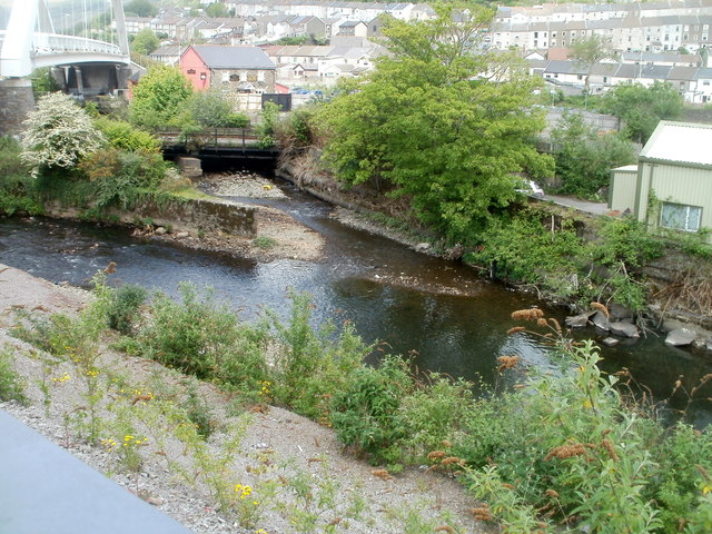
Image: © Jaggery Taken: 6 May 2011
The Rhondda Fawr (Big Rhondda), from the left edge of the view, meets the Rhondda Fach (Little Rhondda) in Porth, adjacent to the Rheola Bridge, http://www.geograph.org.uk/photo/2612363 part of which is in the upper left corner of the view. The merged rivers continue on the right as the Rhondda River.
Images are licensed for reuse under creativecommons.org/licenses/by-sa/2.0
Image Location
Latitude
51.613838
Longitude
-3.410984